
Pearl Harbor Historic Trail concept art – Waipahu depot proposed redevelopment. From PHHT Master Plan.
The Pearl Harbor Historic Trail (PHHT) is a multi-use path that will run 18.6 miles from Halawa Landing to Nanakuli, linking neighborhoods, historic sites, recreational areas, regional attractions, and nature along the old O’ahu Railway & Land Company (OR&L)’s right-of-way. In 2000, a community vision group authored a master plan envisioning ways of wisely developing this right-of-way to achieve the following 4 goals:
- Create an outdoor recreation and transportation network.
- Use the OR&L right-of-way as a springboard for historic preservation and education.
- Create economic opportunities for community businesses.
- Enhance environmental preservation and education.
Trails and greenways are a proven way of improving quality of life, increasing property values and stimulating economic growth.
*All images on this page are from the Pearl Harbor Historic Trail master plan, linked below.
Documents
- Pearl Harbor Historic Trail Master Plan (PDF; 17.1 MB; May 2001)
More Images

Map of Pearl Harbor Historic Trail. From PHHT Master Plan.
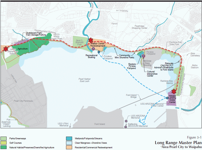
Proposed redevelopment of Aiea’s coastline under the Pearl Harbor Historic Trail master plan. From PHHT Master Plan.

Concept art of the Pearl Harbor Historic Trail as it passes through Nanakuli. From PHHT Master Plan.


0 Comments
1 Pingback